Calgary grows past 1.6 million residents, with projections approaching 2 million in the coming decades. The Calgary Plan structures this growth around complete communities, transit corridors, and activity centres connected to the LRT network. Higher-density housing, mixed-use projects, and redevelopment are focused along main streets and station areas, with land use directed toward intensification of serviced land.
Sustainability is embedded in this framework through land efficiency, reduced infrastructure expansion, and proximity between housing, work, and daily services.
These conditions define how sites are redeveloped and how new projects integrate into the urban structure, setting the framework in which 3D visualization in Calgary becomes part of the project workflow.
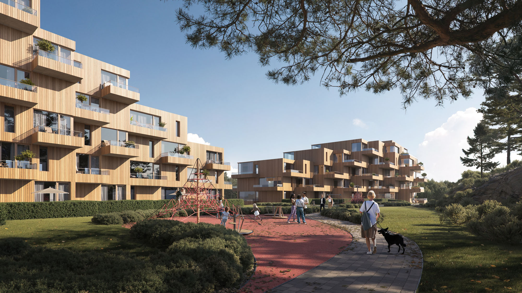
Rising Demand for Low Carbon Buildings Across Calgary
Calgary’s planning framework is shaped by long-term sustainability targets that extend toward 2050. Net-zero direction is embedded into municipal policy, where building performance, emissions reduction, and infrastructure efficiency influence how projects are reviewed and approved.
Around 50% of the existing building stock in Calgary is expected to remain in use by 2050. This places equal importance on new construction and deep retrofit programs that focus on envelope upgrades, mechanical systems, and renewable energy integration across residential and commercial buildings.
New developments move through early approval stages that include energy benchmarking, disclosure requirements, and net-zero-ready expectations. A single project is often reviewed through several layers at the same time: energy models, architectural plans, and technical reports. Each one describes a different part of the building, but the overall picture is not always easy to read as one complete system.
Communicating Sustainability Goals With Architectural Visualization
Sustainability targets in Calgary are usually documented through energy models, compliance reports, and technical drawings. These materials are accurate, but they often stay within specialist workflows.
Architectural visualization translates these parameters into spatial form. Envelope thickness, glazing ratios, shading devices, and landscape strategies can be shown in a single view, supported by realistic lighting and site conditions. This makes it easier to understand how sustainability decisions affect the actual experience of the building.
For example, daylight performance studies can be visualized across different seasons, showing how interior spaces respond to solar exposure. In the same way, façade systems designed for energy efficiency can be presented in relation to material choices and urban context, which supports clearer communication between technical and non-technical stakeholders.
Helping Developers and Design Teams Align Design Intent
Large projects in Calgary typically involve the chief architect, engineers, consultants, developers, and marketing teams working in parallel. Each group focuses on different priorities: performance, cost, feasibility, presentation, or compliance.
Architectural plans and simple sketches often describe intent at different levels of detail, but they do not always communicate the same version of the project across all teams. This creates variations in interpretation as the design develops. When teams work from the same visual base, discussions become more focused on decisions rather than the interpretation of drawings. A coordinated model shows how individual design decisions come together in real life, supporting more stable coordination across the project lifecycle.
3D rendering in Calgary provides a shared visual reference that keeps design intent consistent. A single coordinated model can be used to review site plans, massing studies, and interior layouts in one environment. This becomes especially valuable in large-scale developments, where multiple consultants contribute to the same architectural system. We'll return to this topic later and explore how visualization supports large, multi-phase projects.
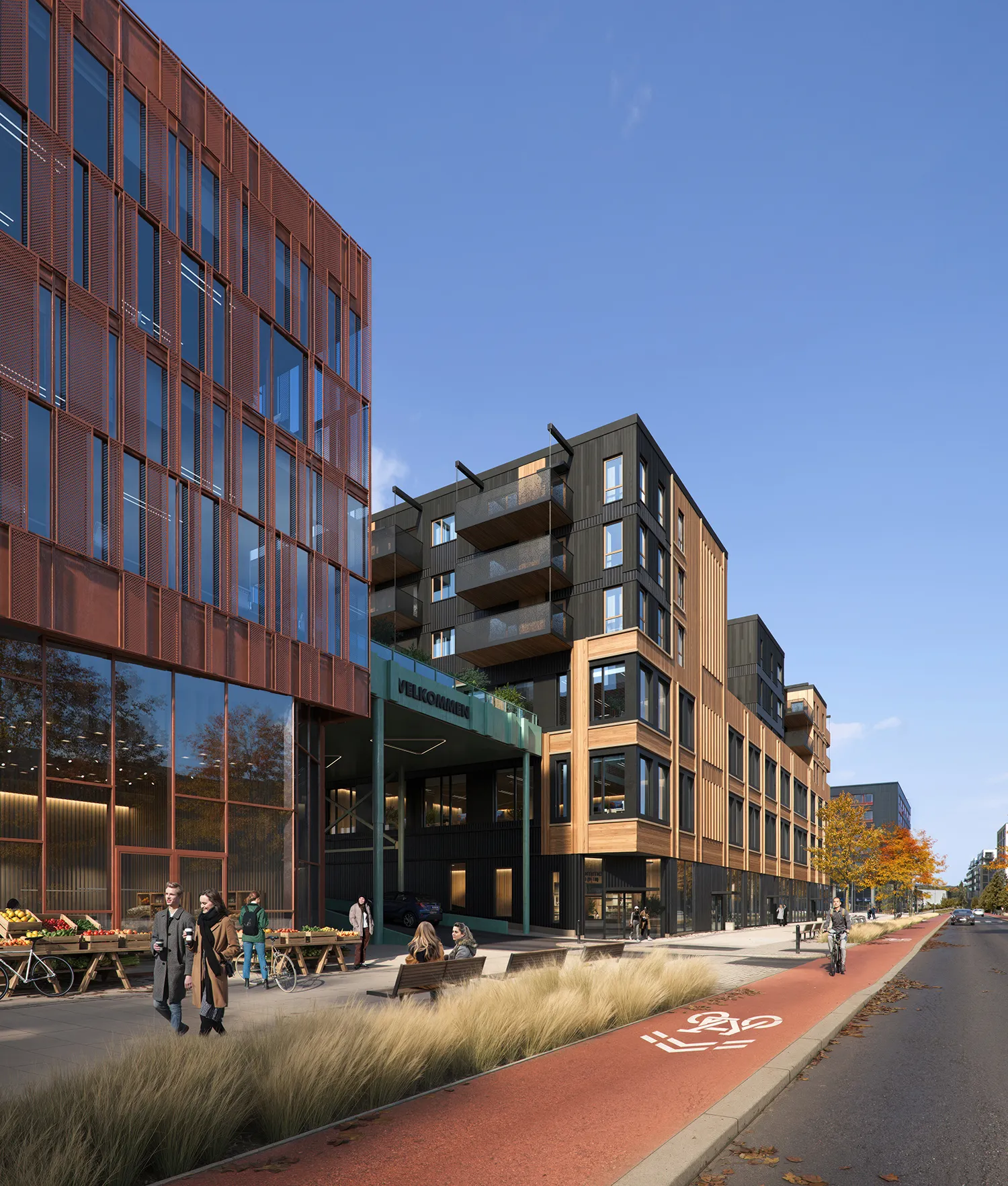
Reducing Approval and Rework Risk Before Construction
As projects progress through approvals, design changes become more costly and time-consuming. A modification to massing, façade design, or site layout can affect multiple technical systems at once, including structure, mechanical planning, and documentation sets.
Early visualization helps identify these relationships before construction documentation is finalized. Issues related to scale, shading, circulation, or urban integration can be observed in context rather than discovered during later review stages.
For developers and design teams, this reduces the likelihood of late-stage redesigns and improves clarity during municipal review processes. It also supports more predictable coordination between design intent and regulatory expectations, especially in projects that must align with Calgary’s long-term sustainability and development frameworks.
Using 3D Rendering Services Calgary to Speed Approvals
Municipal approvals depend heavily on communication. A project may be technically compliant, but if stakeholders struggle to understand its impact, additional review cycles often follow.
This is particularly relevant in Calgary, where public participation forms part of many planning and development processes.
The City's Development Map already uses visual tools and three-dimensional representations to help residents understand how projects fit into the broader urban environment.
Professional 3D rendering Calgary supports the same objective.
Presenting Architectural Plans for Faster Municipal Review
Architectural plans contain a significant amount of information, which requires technical knowledge to interpret correctly. Floor plans, sections, elevations, and site plans explain how a project is designed. They do not always explain how the project will be experienced. A rendering provides that missing layer of understanding.
Reviewers can immediately assess scale, streetscape relationships, pedestrian conditions, landscaping, and overall visual impact.
Questions that might require multiple drawing reviews can often be answered through a single image.
Aligning Architects, Developers, Marketers, and CGI Teams
When teams work from different assumptions, inconsistencies begin to appear across presentations, approvals, and marketing materials. A shared visualization workflow helps maintain consistency. Architects can review design accuracy. Developers can verify project positioning. Marketing teams can prepare launch materials. CGI artists can build assets that support multiple project phases. So it gives a more coordinated process with fewer revisions.
Supporting Large Scale Developments With Accurate Visual Packages
At this scale, isolated architectural views are not enough. The main question shifts toward how the entire development behaves within its surrounding urban fabric.
Urban Design Rendering becomes the central tool for this level of evaluation. It shows the relationship between building massing, street hierarchy, open spaces, pedestrian movement, and infrastructure flow. Density, height transitions, and spatial gaps are read as a continuous system rather than separate architectural elements.
This type of visualization is used to test how new districts integrate with existing neighbourhoods, how public spaces connect across the site, and how movement patterns shift once the development is in place. It also makes it possible to compare different masterplan options without relying on abstract diagrams or technical drawings alone.
For large-scale projects, urban design visuals often sit alongside site plans, massing models, and phased development studies, forming a single reference point for design coordination and review discussions across teams and stakeholders.
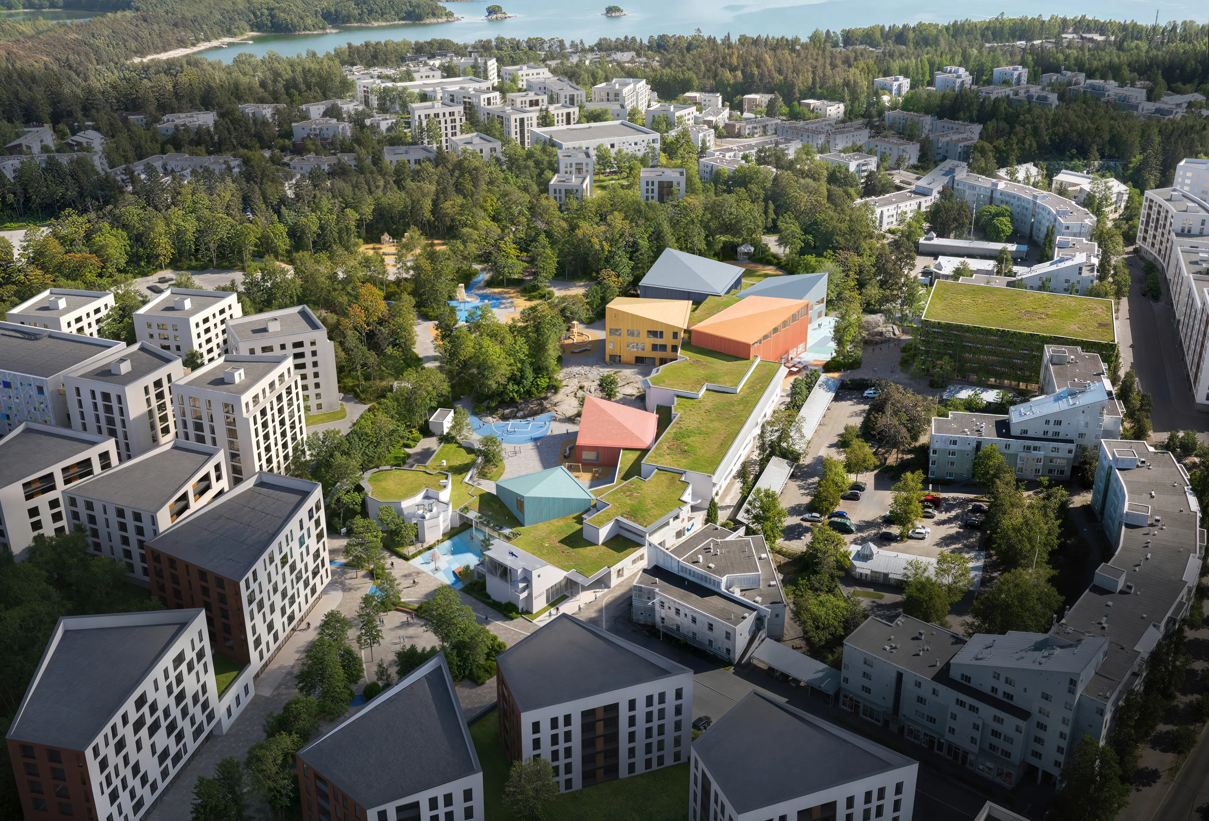
Turning Simple Sketches Into Approval Ready 3D Renderings
A project in Calgary can start with something as simple as a sketch on a meeting table. For example, a developer might outline a mid-rise building along a transit corridor with a rough note on height, access points, and a small public plaza. At that point, the main question is usually not about detailing, but about how the building will sit in the street and how it will affect its surroundings.
When this sketch is translated into a 3D massing model, the discussion changes. The building height can be read against neighbouring structures, the distance to the street becomes visible, and the scale of the public space can be felt in context. Even basic shadow studies begin to show how the form behaves during different parts of the day.
In mixed-use projects, early diagrams often separate functions like parking, residential volume, and retail frontage. In a 3D view, these elements start to interact. A parking entrance that seemed neutral on paper can affect pedestrian movement, and a shifted tower position can change how the street edge feels.
The same applies to smaller residential projects. A simple façade sketch becomes more concrete when placed into a modeled street with light and surrounding context. Material intent, proportion, and rhythm are easier to read when they appear in space rather than on paper.
This is where early architectural ideas become easier to discuss across teams, before the design moves deeper into technical development.
Reducing Rework With Shared 3D Modelling Assets
Building information in Calgary projects changes continuously as design decisions move between disciplines. Materials get replaced as sustainability targets are refined, floor layouts adjust to improve efficiency, and façade systems evolve to meet energy and performance requirements.
With a shared 3D model, these updates stay in one coordinated environment. When a change is made to the geometry, it can immediately be checked against how it affects shading, massing, and spatial relationships before anything is built.
This is especially important in sustainable and low-carbon buildings, where early testing of options like envelope performance, glazing ratios, or orientation can influence long-term energy use. Adjustments made after construction begins are significantly more complex, both in cost and in timeline, so most decisions benefit from being validated at the modelling stage.
Instead of recreating drawings and visualisations across separate files, teams work from a single model that carries updates through all views. This keeps architectural, engineering, and visualization work aligned while different design options are still being explored.
Sustainable Building Marketing With 3D Rendering in Calgary
Sustainable developments are no longer communicated through a single presentation or a fixed set of images. Marketing now runs across multiple channels at the same time: investor decks, leasing presentations, planning submissions, website campaigns, social media, and public consultation materials. Each channel requires its own format, yet all of them need to describe the same project in a consistent way.
When these materials are created by different teams or assembled in fragments, small inconsistencies begin to appear. Lighting changes from one image set to another. Materials are interpreted differently in animation compared to static visuals. Floor plans feel disconnected from exterior views. Over time, the project becomes harder to read as a single idea.
A unified visualization process, built inside one rendering studio in Calgary, keeps these outputs aligned from the start. The same architectural plans, site plan data, and design intent are translated into a coordinated set of exterior renderings, interior rendering services, and presentation assets that work across all platforms.
Creating Marketing Packages for Commercial Developments
Commercial projects rely on early communication long before construction begins. Leasing teams prepare brochures, investors expect clarity on positioning, and developers often need approval-ready marketing material during design development.
A structured marketing package usually combines exterior renderings, key interior spaces, site context views, and simplified diagrams of circulation and public realm. When these assets are produced within one architectural visualization workflow, the tone, perspective, and level of realism remain consistent, even when materials are adapted for different audiences.
Immersive 3D Virtual Tours for Real Estate Teams
360 Virtual Tour Services have become a standard tool for real estate professionals working on commercial and residential developments. They are used in leasing discussions, investor meetings, and pre-sales campaigns where physical access to the building is not yet possible.
A well-built 3D virtual tour connects floor plans with spatial experience. Users move through corridors, lobby spaces, residential units, and shared amenities while maintaining a clear sense of scale and layout. For large-scale developments, this reduces the gap between technical documentation and spatial understanding.
Showcasing Residential and Mixed Use Developments
Residential house developments and mixed-use projects are often evaluated through both financial and emotional criteria. Buyers and tenants respond to light, proportion, views, and everyday usability of space.
Visualization allows these elements to be shown before construction. 3D Exterior Rendering Services capture a building's presence within the neighbourhood. 3D Interior Visualization Services communicate material choices and spatial comfort.
Virtual Staging for Real Estate can be used to show furnished spaces that reflect different lifestyles and use cases.
Using Realistic Lighting to Show Material Value
Material decisions are often made early in the design process, but their impact becomes visible only when light interacts with surfaces.
Realistic lighting in high quality architectural renderings helps explain how stone, glass, wood, and metal behave under different conditions. Morning light, overcast conditions, and evening scenes reveal variations in texture, reflection, and atmosphere that influence both design approval and marketing perception.
Repurposing One 3D Scene Into Renders, Tours, and Animation
A single architectural model can support multiple outputs when it is built with a shared visualization structure. The same scene can generate exterior renderings, interior perspectives, walkthrough animations, virtual tours, and marketing package visuals.
This approach reduces repetition in production and keeps the visual language of the project consistent across all communication channels used by developers, interior designers, and real estate professionals.
Working With a Rendering Studio Calgary for Faster Launches
Marketing timelines rarely follow construction timelines. Campaigns often need to launch while architectural plans are still evolving. A rendering studio manages this through a coordinated production pipeline where exterior rendering services, interior rendering services, animation, and virtual tours are developed in parallel, so updates in design intent are reflected consistently across all deliverables.
But how to choose the right one?
- Many studios now work remotely across different cities and time zones. Location is no longer the main factor. What matters is whether the team understands architectural projects and how design decisions translate into construction and presentation.
- The portfolio is the main filter. Look for clarity in residential, commercial, and large-scale developments. Good visualization services make it easy to read space, circulation, and how a project fits its surroundings, even without technical drawings.
- Experience across different Canadian cities can also be a useful reference point. When reviewing work like 3D Architectural Visualization in Vancouver, 3D Rendering in Toronto, and 3D Architectural Rendering in Montreal, focus on how consistently the studio adapts to different urban contexts, densities, and building scales.
Bring Sustainable Projects to Market Faster
In Calgary, sustainable architecture has become a standard condition of development. Energy performance, emissions targets, and long-term climate objectives are integrated into planning, design review, and approval processes.
This creates demand for teams that can work clearly with these requirements from the earliest stages of a project. Translating complex technical and spatial information into a coherent visual structure supports coordination between design, engineering, development, and review stakeholders.
Architectural visualization plays a central role in this process by aligning how projects are understood and communicated across disciplines.

All images © CYLIND
