Architectural projects rarely exist in isolation. In most cases, they connect to a street — active or quiet, main or secondary — and become part of the surrounding urban fabric. This is the space between the building and the curb, between an entrance and the point where someone steps off a bus or turns the corner.
That narrow zone reflects real patterns of use. It is shaped by how people walk, what they see, where they slow down, and how they navigate. A clear viewpoint is needed to read the situation — one that accounts for topography, density, perspectives, and behavior.
Streetscape 3D renders offer that viewpoint. It helps assemble the full picture, clarifies design decisions, and enables precise communication about the city using the tools of drawings, models, and technical briefs.
Inside Streetscape Rendering: A Pillar of Architectural Visualization
An architectural project doesn't end at the façade — it continues in the spaces that guide people toward it. That transitional zone holds the key to how architecture is encountered. Streetscape rendering brings this often-overlooked layer into focus.
What Is Streetscape Rendering and Why Does It Matter in Urban Design?
Streetscape rendering is a type of architectural visualization that represents how buildings, public space, and infrastructure interact at street level. By focusing on the experience of space from the pedestrian’s perspective, streetscape rendering helps convey the atmosphere, rhythm, and functional logic of everyday urban life. It forms part of Urban Design Rendering, where architecture is visualized as embedded in the larger urban context.
Its relevance is growing with the adoption of the 15-minute city model — an urban planning approach where essential services, workplaces, and green areas are concentrated within a short walking or cycling distance. The model challenges traditional zoning by promoting mixed-use, localized neighborhoods aimed at reducing car use and improving everyday convenience.
Within the framework of the 15-minute city, streetscape rendering becomes critical for evaluating whether the built form truly enables localized, low-carbon lifestyles. It allows for determining whether proximity is matched by spatial quality, whether walking or cycling routes are safe, intuitive, and inviting, and whether everyday destinations are embedded in a coherent, human-scaled urban fabric.
Key Differences Between Streetscape 3D Renders and Traditional Renderings
Traditional renderings are typically centered on the design qualities of a single building — its geometry, materiality, and aesthetic composition. Streetscape 3D renders, on the other hand, frame architecture within its immediate surroundings, emphasizing how it shapes and responds to public space. These visualizations highlight spatial flow, street-level activation, and the interaction between built form, circulation networks, and surrounding density, offering a more integrated view of urban experience.
The Role of 3D Modeling in Creating Realistic Streetscapes
A well-developed digital model makes it possible to recreate a street as it will feel in real life. In this context, modeling services function as an engineering process, grounded in geospatial data, shop drawings, BIM models, and regulatory guidelines. It involves a detailed representation of road geometry, sidewalk slopes, traffic elements, greenery, and user interaction, from pedestrians to cyclists and transit users. This level of detail transforms a streetscape rendering into a precise digital preview of the future urban design.
Why Floor Plans Alone Aren’t Enough
While floor plans, technical documentation, and shop drawings serve the internal needs of design teams, they often lack the clarity required to communicate effectively with external audiences. Streetscape renders act as a visual language, translating complex architectural intent into tangible images that demonstrate how a street will function and feel in real life.
In mixed-use environments like those envisioned in the 15-minute city model, spatial complexity increases: multiple functions coexist within a compact area, pedestrian and cycling routes intersect with public transport nodes, and daily activity is distributed across a dense urban grid. Capturing and communicating this layered reality through plans alone is ineffective. Streetscape renderings simplify this complexity—showing how diverse functions connect, how people move through space, and how proximity is experienced at street level. They help real estate investors, city officials, or communities quickly grasp the logic of an integrated, walkable urban system.
Virtual Tours and 3D Visualization as a Way to Convey the Vision
If the goal is to create a sense of immersion in the future city environment, interactive walkthrough renderings and VR presentations are key. These tools make the streetscape experience truly immersive, allowing viewers to move along façades, assess storefront depth, surface textures, greenery, and route comfort. This format enables people to experience daily usage scenarios long before implementation.
How Streetscape 3D Rendering Enhances Architectural and Development Projects
Beyond design clarity, streetscape rendering delivers strategic value across every phase of a project. From winning stakeholder trust to shaping public perception and boosting market appeal, this visual tool strengthens the impact of both architecture and urban development.
A Trust-Building Tool for Investors
Photorealistic rendering services help reduce skepticism by showing the project’s integration into city life. Especially in international real estate contexts, where investors and buyers may lack direct familiarity with the location, realistic urban visuals provide clarity and orientation.
Such context also plays a decisive role for investors, reflecting buyer priorities—neighborhood quality for 59%, visual appeal for 26%—that influence value and sales velocity.
Integration in Urban Planning and Design
In the context of urban design and urban planning, streetscape rendering allows project teams to visually demonstrate how a proposal will influence its surroundings. These visuals are often used alongside 3D Aerial View Rendering Services to show the project’s scale, connectivity, and interaction with transport and ecological infrastructure, crucial for presentations to planning councils, municipalities, and environmental departments.
Engaging the Public Through Visualization
Effective 3D renders also play a vital role in public hearings and consultations. A detailed streetscape render can showcase improvements like safer walkways, green corridors, and new public spaces, helping reduce resistance and increase public support.
Marketing Power of Streetscape Renders
Streetscape 3D renderings are used well before construction begins as part of real estate listings, pitch decks, digital campaigns, and social platforms. This reflects a broader shift in how property is marketed: 91% of U.S. realtors now use social media to promote listings, and 70% see direct business results.
High-quality 3D rendering services allow the future street to be presented with realism that drives emotional engagement and fast-tracks sales. In competitive markets with dense development, compelling exterior rendering becomes central to strategy—see examples in 3D Architectural Rendering in Sydney and 3D Architectural Rendering in New York.
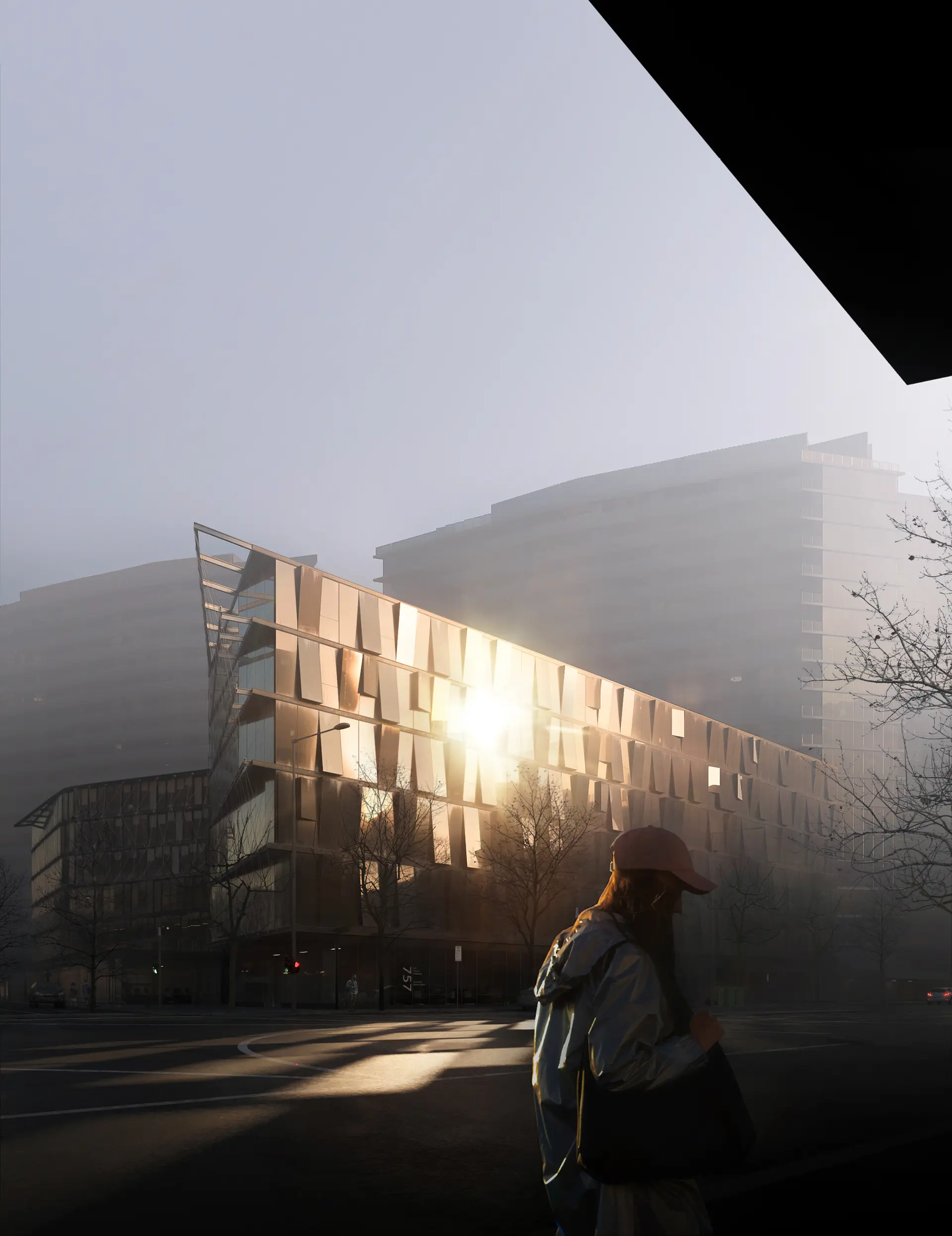
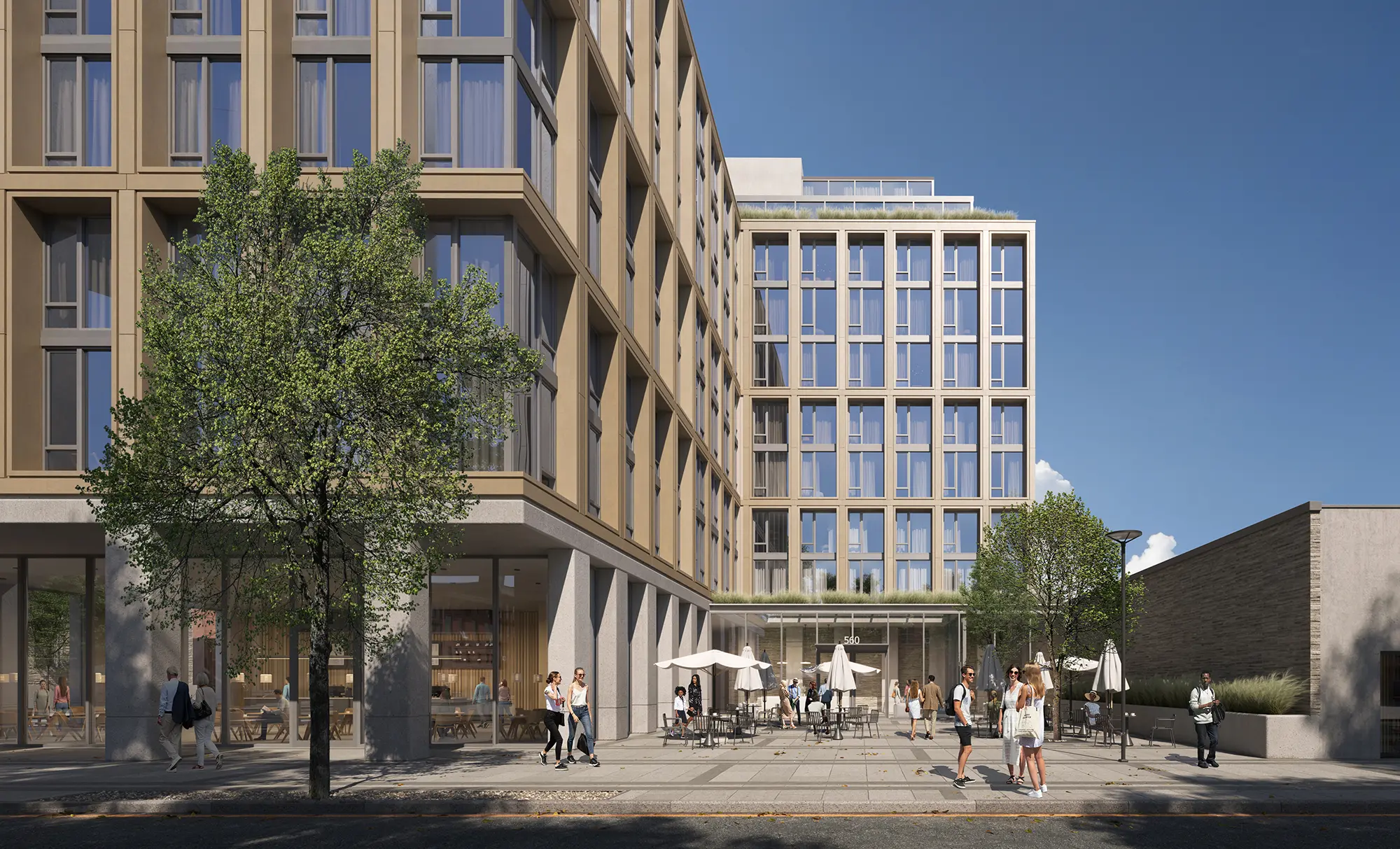
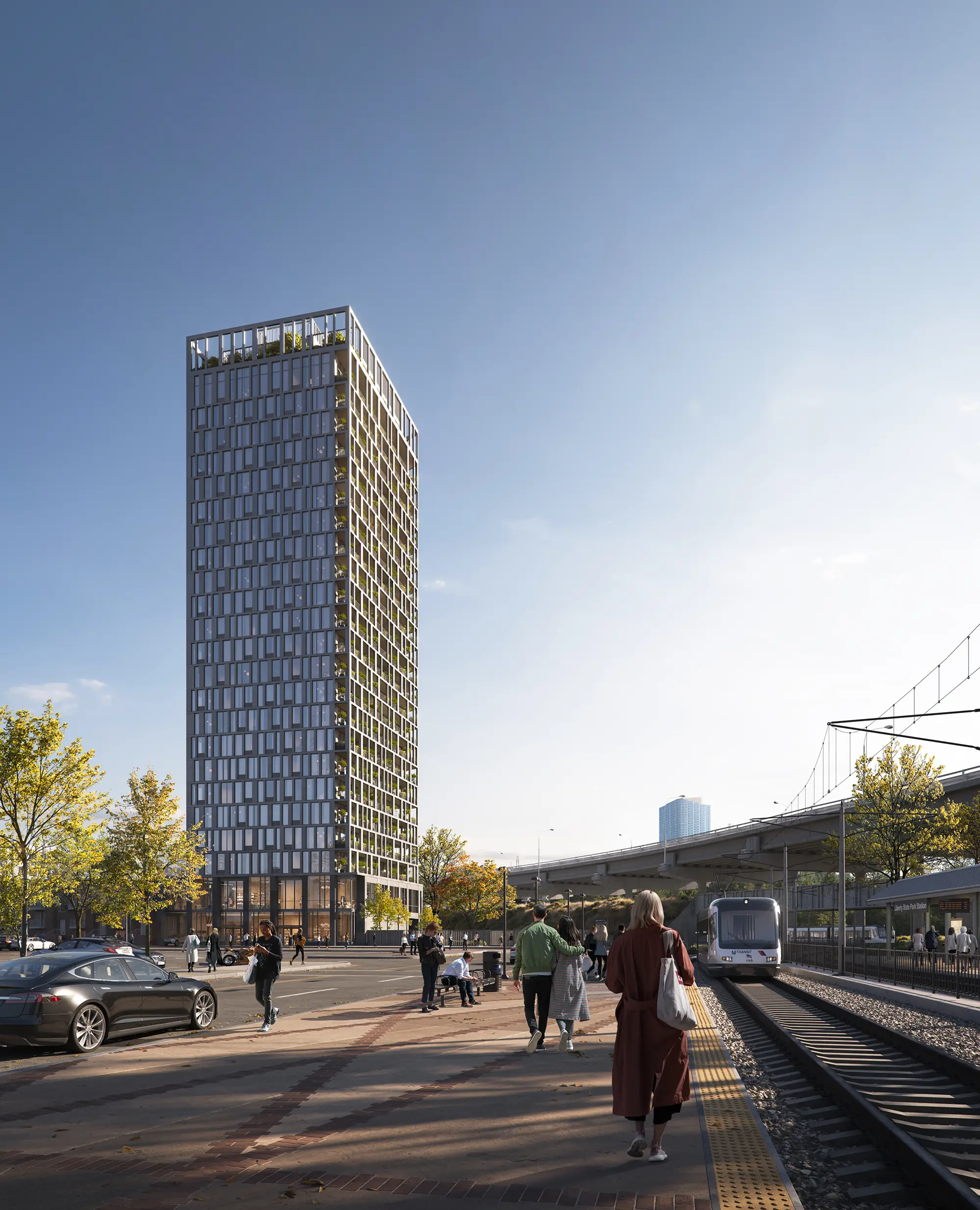
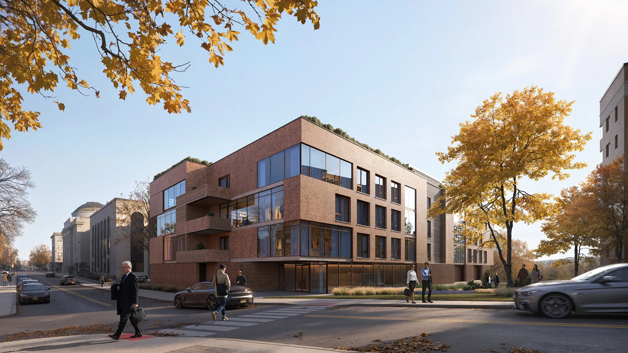
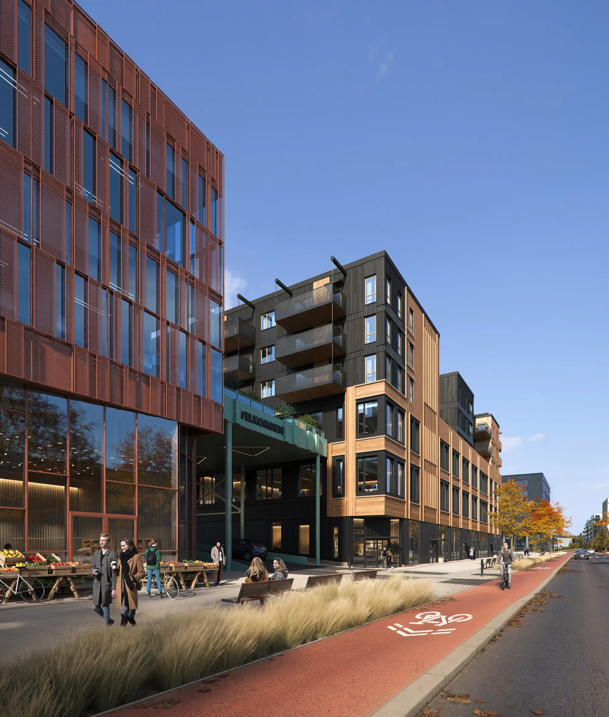
Case Studies: From Commercial Streets to Residential Blocks
CYLIND is a global architectural visualization studio with projects across the USA, Europe, and the Middle East. Our portfolio includes large-scale real estate developments and mixed-use urban districts. We offer Commercial Architectural 3D Rendering Services and Real Estate 3D Rendering Services, including interior rendering and streetscape renders tailored to the goals of developers, municipalities, and design firms — each solution adjusted to local climates, regulations, and user needs.
Below are selected examples showcasing how our streetscape renderings support architecture, planning, and communication across diverse urban contexts.
Norway / Finland (Lappajärvi):
We used streetscape 3D rendering to visualize cycling infrastructure and pedestrian links. The scene was based on real topography, road profiles, street furniture, lighting, and green infrastructure, creating a model that allowed safe movement scenarios to be tested.
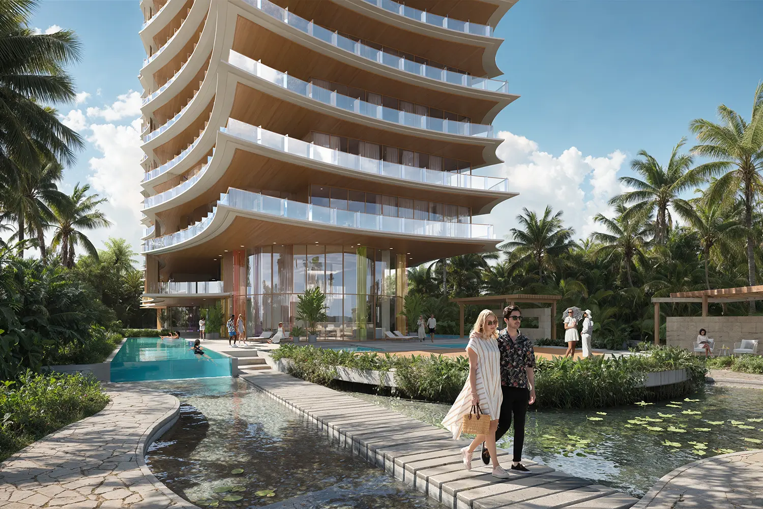
Miami (Surfside Tower):
In a coastal environment, our team focused on capturing atmosphere, nuanced glass reflections, and interaction with the local coastal climate. The exterior rendering conveyed a sense of light, luxury, and fluidity, reinforcing the project’s high-end positioning and elevating its marketing impact.

How to Choose a Reliable Visualization Partner
Not all visualization studios deliver the same level of depth, realism, or strategic value. Choosing the right partner means looking beyond portfolios — toward process, team structure, and the ability to respond to real-world complexity. Discover marketing 3d renders in detail to see how tailored visuals drive success in real estate and urban projects
What to Look For in a Streetscape Visualization Studio
The best studios have deep experience across various urban conditions: business districts, transit corridors, waterfronts, and residential neighborhoods. This shows their ability to adapt 3D rendering services to different densities, flows, and project goals, from marketing to municipal approval.
How Premium Visualization Teams Achieve Realism and Impact
Great modeling services require professionals with architectural and urban backgrounds. Teams often include 3D artists, an art director to oversee visual storytelling, and a project manager to ensure timelines and smooth communication. This expertise becomes particularly valuable in complex vertical developments — learn more about tower rendering to understand how specialized teams handle the unique challenges of high-rise visualization.
Custom Modeling as a Competitive Edge
Stock libraries often don’t capture the unique identity of a site. In complex projects like transport hubs, sustainability-driven developments, or high-tech campuses, essential objects—solar panels, water-permeable surfaces, recycled-material benches—may not exist off the shelf. That’s where custom 3D modeling becomes a key differentiator.
In premium projects, hand-crafted 3D renders reflect unique branding and design, from lighting and paving to wayfinding and public spaces. This attention to detail delivers accuracy and emotional resonance, especially in climate-sensitive regions like Australia, where 3D Rendering Services for Australian Architects respond to environmental and material specificity.
Budget and Timing: What Affects Cost
The cost of a streetscape render depends on detail, modeling complexity, and the number of perspectives. Simple scenes using standard libraries may cost $800–$1,200 per view. Custom architecture and infrastructure increase the price to $2,500–$5,000 per image.
Top studios working in New York, London, Sydney, Melbourne, and Dubai often include BIM, GIS, daylight simulation, and custom modeling. Full packages may reach $10,000–$15,000+, especially if virtual tours, animations, or multiple formats are included.
Key Questions Before You Start
Before launching the project, align with your team on what scene to depict, who the audience is, and what goal the rendering services should serve. Clarify the needed detail, floor plans, source files, and formats. Discuss possible interactivity and revision needs. This planning stage helps ensure that your streetscape 3D render is not only beautiful but also purposeful.

All images © CYLIND
